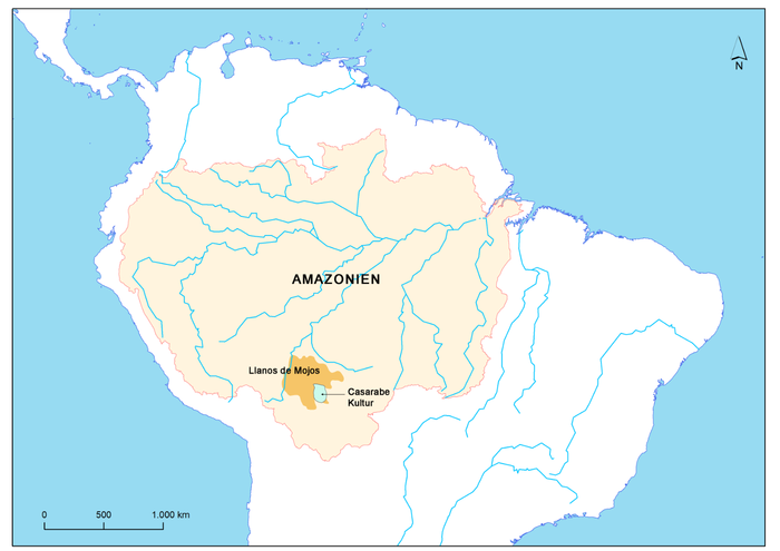
More than 20 years ago, Dr. Heiko Prümers from the German Archaeological Institute and Prof. Dr. Carla Jaimes Betancourt from the University of Bonn, at that time a student in La Paz, began archaeological excavations on two mounds near the village of Casarabe, Bolivia. The Mojos Plains is a southwestern fringe of the Amazon region. Even though the savannah plain, which flooded several months a year during the rainy season, does not encourage permanent settlement, there are still many visible traces of the time before Spanish colonization at the beginning of the 16th century. Next to the mounds, these traces include mainly causeways and canals that often lead for kilometers in a dead straight line across the savannahs. Evidence of cities found in the Amazon.
“This indicated a relatively dense settlement in pre-Hispanic times. Our goal was to conduct basic research and trace the settlements and life there,” said Prümers.
In earlier studies, the researchers already found that the Casarabe culture – named after the nearby village – dates to the period between 500 and 1400 AD and, according to current knowledge, extended over a region of around 16,000 square kilometers. The “mounds” turned out to be eroded pyramid stumps and platform buildings.
Initial conventional surveys revealed a terraced core area, a ditch-wall enclosing the site, and canals. In addition, it became apparent that some of these pre-Hispanic settlements were enormous in size.
“However, the dense vegetation under which these settlements were located prevented us from seeing the structural details of the monumental mounds and their surroundings,” said Betancourt.
LIDAR technology used in the Amazon for the first time
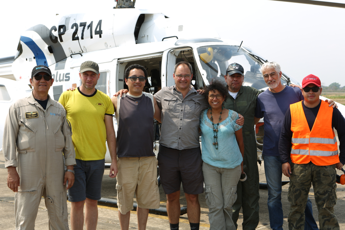
To find out more, the researchers used the airborne laser technology LIDAR (Light Detection and Ranging) for the first time in the Amazon region. This involves surveying the terrain with a laser scanner attached to a helicopter, small aircraft, or drone that transmits around 1.5 million laser pulses per second. In a subsequent evaluation step, the vegetation is digitally removed creating a digital model of the earth’s surface, which can also be displayed as a 3D image.
“The first results were excellent and showed how effective the technology was even in dense rainforest. From that moment on, the desire arose to map the large settlements of the Casarabe culture using LIDAR technology,” said Heiko Prümers.
Large settlements found
For the current study, in 2019 the team together with Prof. Dr. José Iriarte and Mark Robinson from the University of Exeter mapped a total of 200 square kilometers of the Casarabe cultural area. The evaluation done by the company ArcTron3 held a surprise. What came to light were two remarkably large sites of 147 hectares and 315 hectares in a dense four-tiered settlement system.
“With a north-south extension of 1.5 kilometers and an east-west extension of about one kilometer, the largest site found so far is as large as Bonn was in the 17th century,” said Betancourt.
It is not yet possible to estimate how many people lived there.
“However, the layout of the settlement itself tells us that planners and many active hands were at work here,” said Prümers.
Modifications made to the settlement, for example, the expansion of the rampart-ditch system, also speak to a reasonable increase in population.
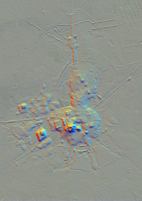
“For the first time, we can refer to pre-Hispanic urbanism in the Amazon and show the map of the Cotoca site, the largest settlement of the Casarabe culture known to us so far,” Prümers said.
In other parts of the world, similar agrarian cities with low population densities had already been found.
LIDAR shows anthropogenically altered landscape
LIDAR mapping reveals the architecture of the settlement’s large squares, including stepped platforms topped by U-shaped structures, rectangular platform mounds, and conical pyramids (up to 22 meters high). Causeway-like paths and canals connect the individual settlements and indicate a tight social fabric. At least one other settlement can be found within five kilometers of each of the settlements known today.
“So the entire region was densely settled, a pattern that overturns all previous ideas,” said Betancourt.
The researchers emphasize that for all the euphoria about the site mappings and the possibilities they offer for reinterpreting the settlements in their geographic setting, the real archaeological work is just beginning. The goal for the future, they say, is to understand how these large regional centers functioned.
Possible cities found in the Amazon
“Time is running out because the spread of mechanical agriculture is destroying a pre-Columbian structure every month in the Llanos de Mojos region, including mounds, canals, and causeways,” said Betancourt. With this in mind, she added, LIDAR is not only a tool for documenting archaeological sites, but also for planning and preserving the impressive cultural heritage of the indigenous peoples of the Amazon.
More information can be found in the study “Lidar reveals pre-Hispanic low-density urbanism in the Bolivian Amazon,” in the journal Nature by authors Prümers, Betancourt, Iriarte, Mark Robinson, and Martin Schaich.